.webp)
.webp)
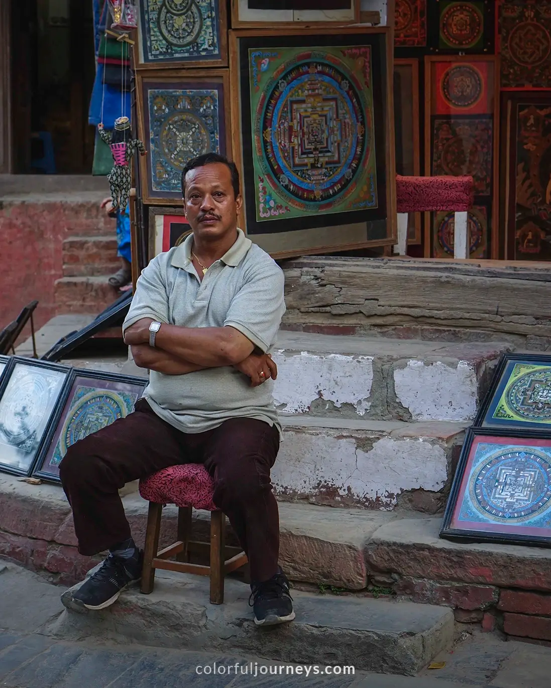
If you are dreaming of hiking the Annapurna Circuit without a guide and wondering if you should do it, let this be your sign and reassurance that - yes, you can and should do it.
To give you a little context, I'm not the fittest person, and after 9 months of traveling around Southeast Asia on my own, I had led a less-than-healthy lifestyle. Also, I am 5’2, my legs are short, and I hadn’t trained in any way for this strenuous hike. Still, I did it together with a girl I met at my hostel in Kathmandu. I hiked the Annapurna Circuit without a guide or a porter.
Will I ever do this trek again? Absolutely, in a heartbeat!
Though if you'd asked me the same question right after my 9th day of trekking, I would’ve told you no. This is a challenging hike, and I recommend preparing for it.
Here is a 9-day Annapurna Circuit trekking itinerary where you can find a day-to-day guide that outlines the route, distance, and estimated time for each day of the trek. I also detailed my experience, including the teahouses, lunch stops, and highlights along the way to help you plan your trek effectively.


.jpg)
Annapurna Circuit Hike Overview
Length: 9 to 15 days
Difficulty: Challenging
Starting Elevation: 840m (2760ft) at Bhulbhule
Peak Elevation: 5416m (17,769ft) Thorong La Pass
Accommodations: Teahouses
Best Time to Trek: October to early December, March and April

Annapurna Circuit Trekking Itinerary
Day 1: Bhulbhule to Jagat
Day 2: Jagat to Dharapani
Day 3: Dharapani to Chame
Day 4: Chame to Upper Pisang
Day 5: Upper Pisang to Manang
Day 6: Manang: Rest Day
Day 7: Manang to Yak Kharka
Day 8: Yak Kharka to Thorung Phedi (Base Camp)
Day 9: Thorung Phedi to Muktinath

Detailed 9 Day Annapurna Circuit Itinerary
Here is a detailed itinerary of my 9-day hike on Nepal's Annapurna Circuit. You'll find the elevation gain of each location, as well as the distance and time it took for us to get there. We've also included the teahouses where we stayed during the trek and what you can expect on the hike itself.
Note that we hiked in October, so depending on when you trek, the weather conditions may vary. Use this route as a rough outline, and be prepared to make adjustments based on your own preferences and the current conditions.
Make sure you’re covered in case of emergencies. Get travel insurance with Heymondo and enjoy 5% off, exclusively for our readers.

Kathmandu to Bhulbhule
Elevation Loss: 560m (1837ft)
Distance by Bus: 187km
Time by Bus: 6 to 9 Hours
Teahouse: Manang Hotel and Restaurant
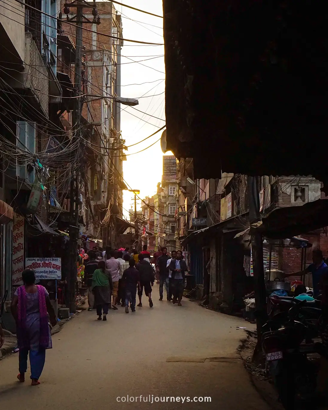
From Thamel (1400m), you can either book a jeep or take the local bus to your starting point. The jeep is the more popular option among tourists due to its convenience.
However, taking a public bus with the locals is an amazing experience you don’t want to miss out on. The local bus isn’t air-conditioned, so it gets hot during the day. But you tend to see more amazing views from the countryside, which makes the heat bearable.
As far as we know, you cannot book your ticket in advance. So, head to the Gongabu Bus Station around 6:30am and buy your ticket at the office.
Tip: Start your trek at Bhulbhule instead of Besisahar. Numerous jeeps and buses go between the villages, so it is not the best place to walk because of the heavy dust and the busy roadways.
Similar to the majority of the villages along the Annapurna circuit, the tea houses in Bhulbhule are situated next to one another. With an elevation of 840m, Bhulbhule is located next to the Marshyangdi River, with about ten tea houses providing simple but comfortable lodging. Plus amazing river views!
.webp)
My Experience
We boarded a local bus from Kathmandu to Bhulbhule, which took around 9 hours. The bus was mostly filled with locals, with the exception of an elderly British couple, whom we ended up seeing a lot on the trail. Along with their Nepali guide and porter, we formed a camaraderie early on and throughout the trek as we shared tea houses and recommendations on which villages to stay in at night.
Once we reached Bhulbhule, we stayed at the first tea house we saw, the Manang Hotel and Restaurant. Our room, located beneath the main restaurant, was modest with two single beds, just enough for a night’s rest. The sound of the river lulling me to sleep and waking me up the next morning was the perfect start to my Annapurna hiking journey.

Day 1: Bhulbule to Jagat
Elevation Gain: 160m (525ft)
Trek Distance: 19km
Trek Duration: 6 Hours
Teahouse: Hotel Mont Blanc
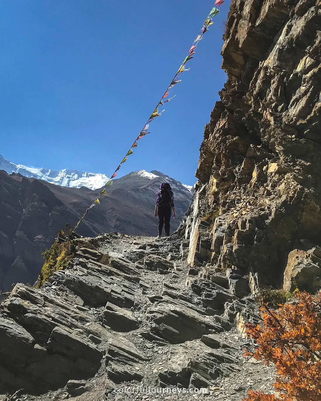
Today marks the first day of your hike on the Annapurna Circuit from Bhulbhule to Jagat. As you are still at a relatively low altitude, it gets really hot during midday. While today’s hike is difficult, you will be rewarded with numerous waterfalls along the way and a picturesque backdrop to enjoy.

You will follow the river and hike along a cliff for the first portion of the trek. As you pass through some green forests, the path becomes steeper and more uphill until you reach Bahundanda (1310m). The climb to the village is tough with countless steep steps to tackle.
Once you reach Bahundanda village, you can stroll around its blue-toned houses and interact with the locals. After passing through the village, there'll be a large stand-alone tree facing a dramatic mountain cliff and you can hear the rushing river below. From here, the rest of today's route will be downhill.

For lunch, stop at the village of Ghermu (1130m) and then continue on to Jagat with an elevation of 1000m. Jagat is a small, colorful village surrounded by lush trees and mountains. Once you reach the village, you will hear people talking about the hot spring nearby.
Turns out, the hot spring is indeed nearby, but the path there is downhill! The hot water will relieve your sore thighs from the whole day of walking, but the climb back up is difficult, resulting in sore thighs once again.

My Experience
Today’s hike was a bit challenging as I was still getting used to the heat, the long day of walking, and carrying my bag.
We stayed at the Hotel Mont Blanc in Jagat Village. It was simple, spacious, and our second-floor room offered large windows providing a spectacular view of the valley. I ended the evening with a plate of Momos (Nepali dumpling) and a cup of creamy hot chocolate.

Day 2: Jagat to Dharapani
Elevation Gain: 860m (2822ft)
Trek Distance: 15km
Trek Duration: 7 hours
Teahouse: Crystal Hotel and Restaurant
Similar to the first day, today's hike has steep trails, hot temperatures, and dusty trails.
You'll most likely wake up with a sore body after yesterday's hiking and carrying your bag. So, make sure you stretch your legs before heading out, and do not skip breakfast!
.webp)
Again, it will be hot during the midday, with many uphill and downhill trails. The view is still spectacular, with rolling green mountains and fields, as well as numerous suspension bridges to cross.
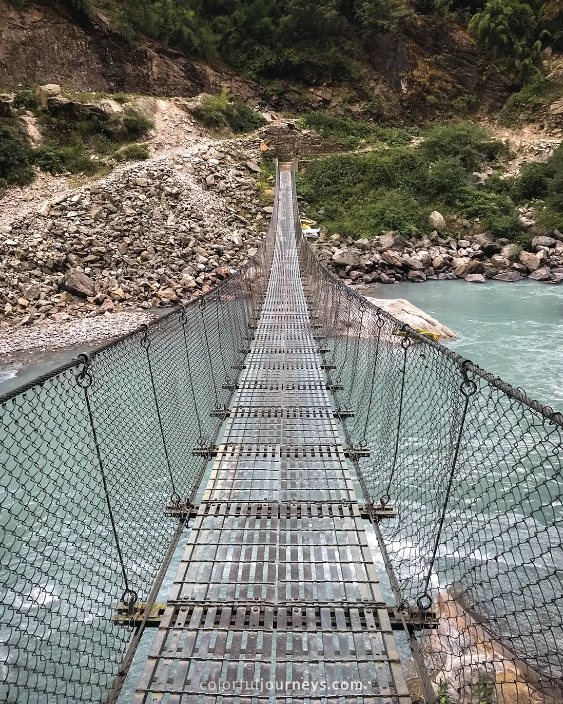
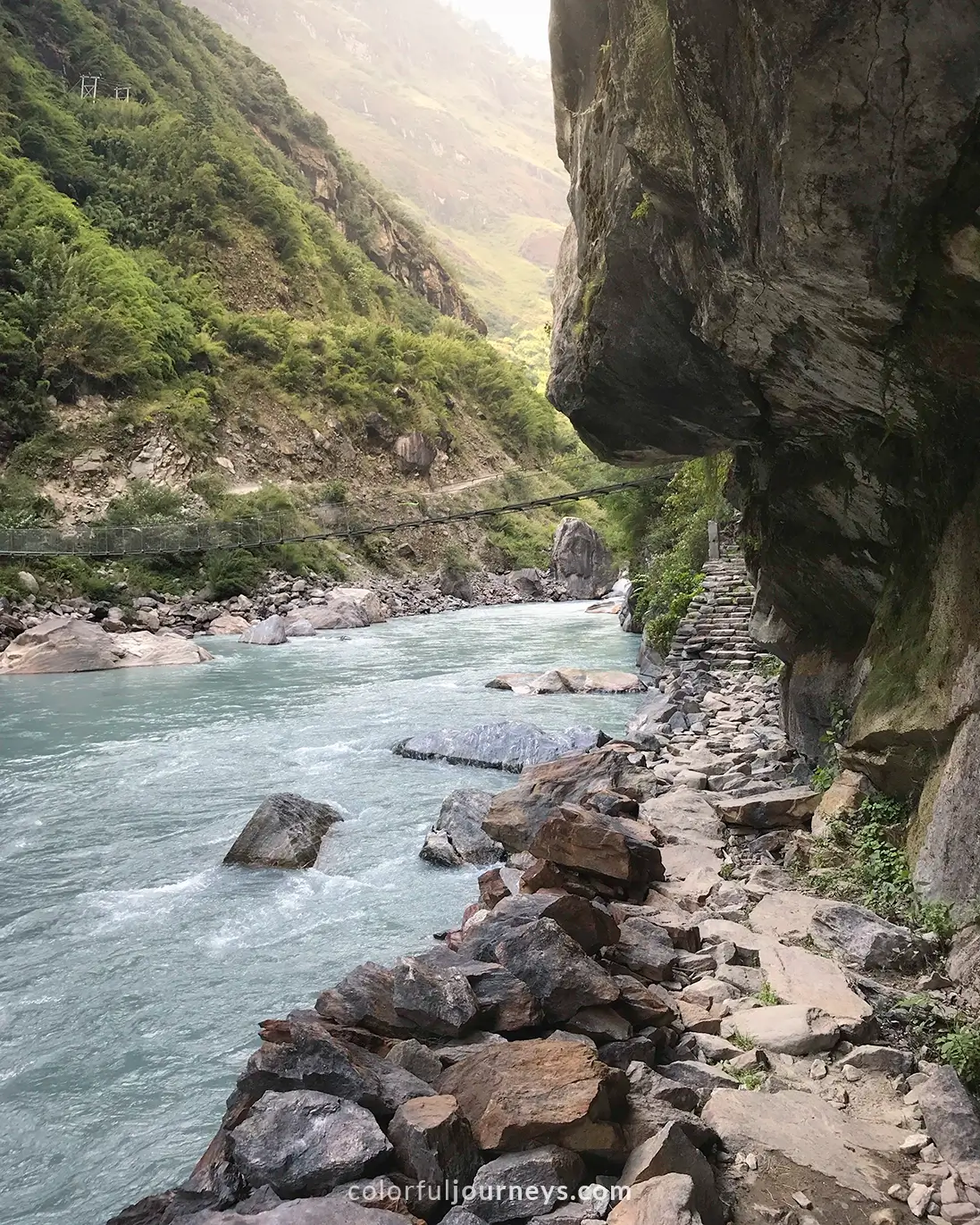
The route from Jagat follows the Marsyangdi river closely. After crossing the river, you will arrive in the colorful village of Tal, which is nestled in the midst of the high mountains. This village houses a lot of restaurants, making it the most logical place to stop for lunch.

You will get closer to the river as you leave Tal village. The rocky trail is sandwiched between the river and the high cliffs, and you’ll be greeted by five waterfalls scattered along the towering green slopes.
From there, you’ll continue to Dharapani village, which is located at an elevation of 1860m.
.webp)
My Experience
We stayed at Crystal Hotel and Restaurant, located towards the end of the village. The brick-built teahouse is situated on higher ground with a large garden. Our room was basic, and the restaurant was warm, but I didn’t necessarily feel cozy, possibly because we were the only guests. I got very cold at night and made a mental note to wear more layers to bed.
Also, we did our laundry and hung it in the garden overnight. This was a bad idea, as we found our clothes completely frozen the next day. As a result, we had to tie our wet clothes on our backpacks.
.webp)
Day 3: Dharapani to Chame
Elevation Gain: 810m (2657ft)
Trek Distance: 15.5 km
Trek Duration: 8 hours
Teahouse: Tilicho Guest House
Today's hike leads from Dharapani to Timang and then to Chame (2,670m), where you'll spend the night. The route passes through a variety of scenery, from massive rock formations to pine trees, and you will catch your first glimpse of the snow-capped mountains!
The temperature tends to fluctuate on the third day as you gain elevation. So remember to layer your clothes!

As you keep walking, the green mountains will slowly disappear to make way for the towering, rocky mountains. One feature of this trail is the steep steps on the side of a massive boulder, which are dangerously close to a cliff.
Stop at Timang village (2624m) for lunch as you take in the majestic view and enjoy the cooler temperature. After Timang, the trail goes downhill into a pine tree forest and then goes uphill once again past waterfalls and between villages.

If you’re struggling, always remember that the higher you climb, the more rewarding the views are. You will pass by the village of Koto (2600m), which is a great option to stop by for some tea and snacks.
From here, it won’t be long until you reach Chame, a village with plenty of teahouses to choose from. There are a few stores where you can shop and restock your snacks. Additionally, you can find gear such as gloves, scarves, and jackets as the weather will get colder after Chame.

My Experience
Despite a solid 8 hours of sleep, I woke up feeling fatigued, and my bag started to feel a bit heavier. As we gained altitude, our pace got slower and my hips started to ache.
After many minutes of stretching my legs during the lunch break, I was able to alleviate the pain. This was the moment I realized how important stretching is. Since then, before I started walking, I made sure to stretch.
.webp)
We stayed at Tilicho Guest House. The rooms circle around a small courtyard in the center, which creates a cozy atmosphere. This was also the most comfortable stay during our trek as the rooms had better insulation.

Day 4: Chame to Upper Pisang
Elevation Gain: 530m (1706ft)
Trek Distance: 14km
Trek Duration: 7 hours
Teahouse: Hotel Royal Nyeshang Cottage
Day four takes you to Upper Pisang (3200m) via Bhratang and Dhukur Pokari. The trail from Chame to Upper Pisang is fascinating with its rushing rivers, mountain hugging roads and snow covered peaks above.

As you leave Chame village following the river, the route will take you past green fields and then through a dense pine forest. After an hour or so, you'll arrive at Bhratang village. You'll pass apple orchards along the side of the road, enclosed in tall fences and clearly marked with signs warning hikers not to pick the apples.
Here, you will find Bhratang Tea House, a cafe where you can buy apples, desserts, and coffee. Expect some crowds as this is a popular rest stop for most hikers, but the apple pies and freshly squeezed juice are worth the wait. There is also a water station just across the cafe to refill your bottles.

Continue on to Dhukur Pokari, where you can have lunch. The trail splits at the end of the village, leading to either Lower Pisang or Upper Pisang. Take the right trail heading to Upper Pisang where the last stretch gets very dusty, so be prepared to do some laundry at your teahouse.

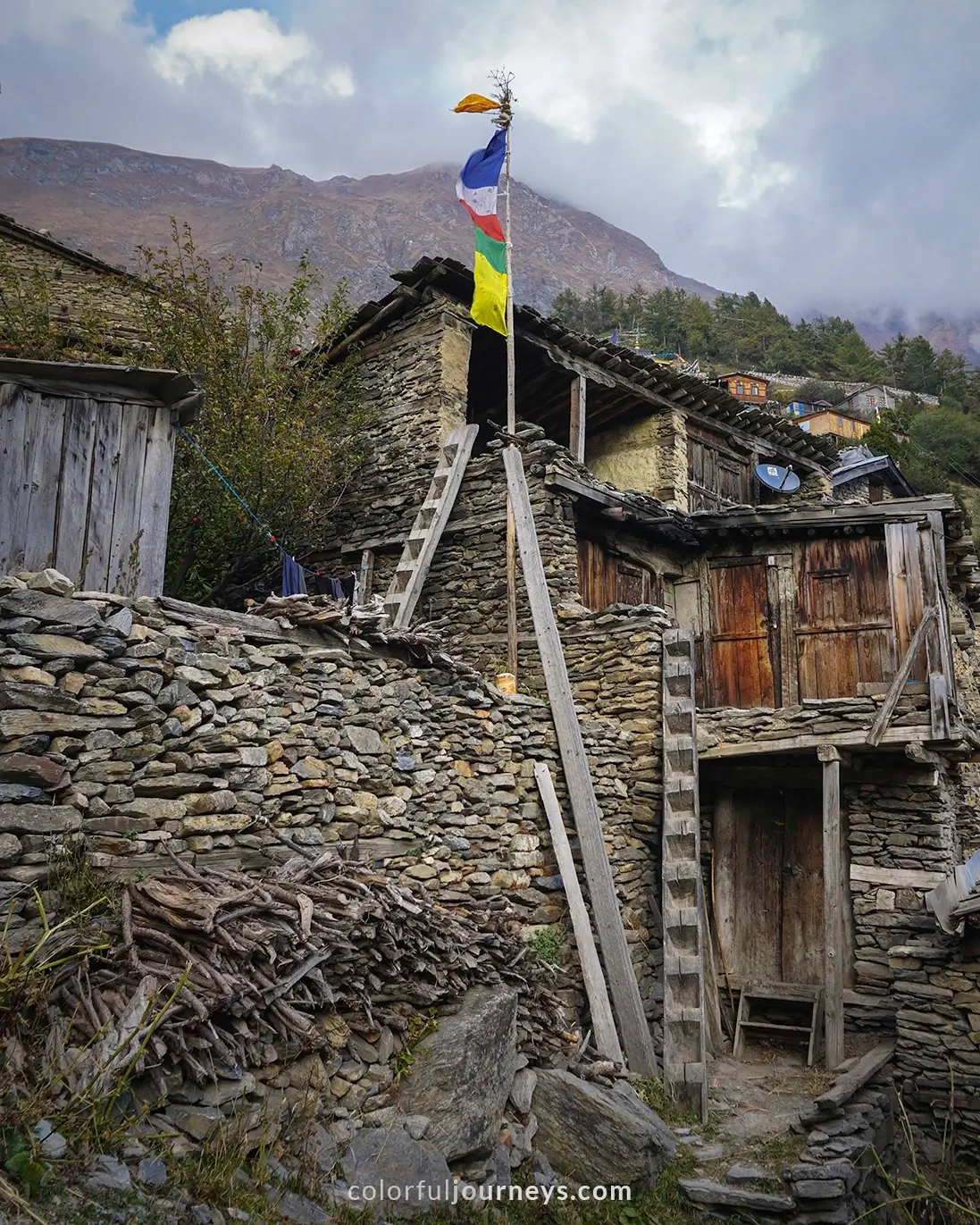
If you arrive early, you should walk around the village. The whole village of Upper Pisang consists of simple stone homes with maze-like walkways throughout the village. There is also a temple at the top of the village where you can witness the locals during their afternoon prayer ceremonies.

My Experience
Though still difficult, I started to get the hang of walking and carrying my bag on day 4. Also, the higher elevation really started to slow me down. Yet, it was this day that I started to really enjoy the trek more and more as the scenery kept getting more spectacular.
We stayed at Hotel Royal Nyeshang Cottage in Upper Pisang. The teahouse was really comfortable, and offered some of the best views of the snow-capped mountains. Particularly unusual was that our room had a toilet inside, the first one we've seen during our trek.


Day 5: Upper Pisang to Manang
Elevation Gain: 340m (1115ft)
Trek Distance: 15km
Trek Duration: 9 hours
Hiking Time: Mountain Lake Resort
The route from Upper Pisang to Manang (3540m) is not only one of the longest and most challenging on the Annapurna Circuit but also offers some of the most breathtaking scenic views you'll encounter.
.webp)
As you depart from Upper Pisang, the landscape transforms from lush green forests to dusty roads. The first hour involves downhill paths, followed by two more hours of navigating narrow and steep ascents that zigzag through the mountains until you reach Ghyaru village (3730 m).
.webp)

Once you reach the village, your efforts will be rewarded with a jaw-dropping panoramic view of Annapurna 2 and 3. There is a temple where you can rest and observe the natural beauty of the Himalayan mountain ranges. You'll also find a woman selling delicious bread in the temple.

Continue down the increasingly narrowing trail from Ghyaru village to Ngawal village, where you can stop for lunch. The trail provides countless photo opportunities, so make the most of each pause.


.webp)
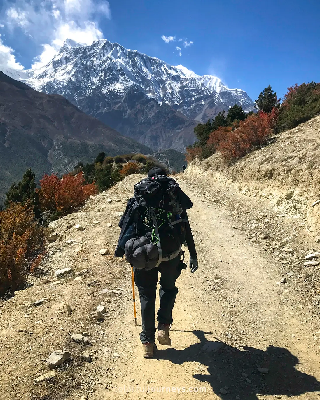
Head next to Manang where you'll be treated to striking views of the distant Annapurna mountains and the expansive valley below. Manang is one of the biggest towns on the trek and offers some of the best facilities. Also, since most of the hikers take a rest day in this village, it is notably the busiest.

.webp)
My Experience
Climbing uphill to Ghyaru village for two hours straight was truly exhausting. However, the journey from Upper Pisang to Manang stands out for its breathtaking views and remains one of my favorite days on the trek.

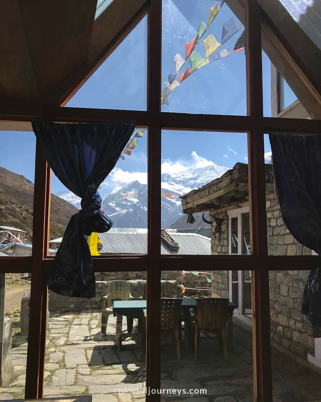
We arrived in Manang pretty late in the afternoon and by this time, most of the accommodations were occupied. Fortunately, the guide we had met on the bus to Bhulbule, and whom we encountered along the way, secured the last room for us at Mountain Lake Resort.
The stone teahouse featured spacious rooms and numerous available toilets. Additionally, the heated restaurant offered a variety of delicious meals, a much-appreciated treat after a long day.


Day 6: Rest Day in Manang
Extra Hike: Praken Gompa
Trek Duration: 2 Hours
It is advisable to take a rest day in Manang to let your body get used to the altitude. In the morning, head up to Praken Gompa for acclimatization, which should take you around 2 hours back and forth.
.webp)
Praken Gompa is a Buddhist temple nestled in a mountain wall towering above Manang at an elevation of 3945m. The trek is relatively easy compared to the last few days since you won't be carrying your heavy bags.
.webp)
Grab a seat at the tea shop close to the summit and enjoy the breathtaking views surrounding it! Head back down to the village, do the last of your laundry and take a long shower while the sun’s still out. This might be the last chance you get as it only gets colder from here on.
.webp)
At 3pm, attend the free seminar at the Himalayan Rescue Association. Here you will receive information about altitude sickness and tips to combat it. They also sell basic medicines.
.webp)
In the afternoon, explore the village and stock up on your snacks! There’s really nothing else to do but to relax and rest on this day. You will need all your energy for the next few days as you gain more elevation, so head to bed early and prioritize getting as much sleep as you can.
.webp)
Day 7: Manang to Yak Kharka
Elevation Gain: 155m (509ft)
Trek Distance: 9.5km
Trek Duration: 5 hours
Teahouse: Hotel Nyeshyang
On day 7, the journey takes you from Manang to Yak Kharka village, situated at an elevation of 4100m. This day is relatively short, allowing for lunch and overnight stay at Yak Kharka if you start early.
.webp)
As you ascend, the air gets thinner, and you may begin to feel more tired and breathless. Take it easy and make frequent stops as needed.
.webp)
Start your trek before 8am and head towards upper Manang, where most of the locals live. You'll ascend steep stone steps and navigate through tight alleys, passing by the stone houses with flat roofs. There’s also a temple along the way where you can stop.


.webp)
Once the road ends, continue on dusty mountain paths. The steady incline at this section makes it easier than the earlier part of the day. Stop at the Chullu West teahouse which is the only place along the route where you can order some hot tea and enjoy the view.
.webp)
The remaining stretch of the trail is dusty, with small shrubs and grasses covering the ground, and has a steady, barely noticeable incline. You might also encounter traffic jams on the path, not caused by cars but the occasional yaks and donkeys carrying their cargo up the hills. So, keep an eye out!
.webp)
Once you reach Yak Kharka, order your lunch right away and take a shower while the sun’s still out. Afterwards, walk around the small village and refill your water bottles at the small water station.
Note: Remember to charge all your batteries since you will need to pay for charging in the next village.
.webp)
My Experience
We stayed at Hotel Nyeshang, situated at the end of the road. We liked how our room was a spacious bungalow with its own toilet and a big front yard, offering magnificent views.
.webp)
We spent the remainder of the day at the restaurant, keeping warm as we awaited dinner. Following our meal, we opted for an early bedtime, ensuring we got as much rest as possible.

.webp)
Day 8: Yak Kharka to Thorung Phedi (Base Camp)
Elevation Gain: 910m (2986ft)
Trek Distance: 6.5km
Trek Duration: 2.5 hours
Teahouse: Thorong Phedi Base Camp Lodge
Today's route takes you from Yak Kharka to Thorong Phedi, also known as Base Camp, situated at 4450m. It is the shortance distance on the circuit but also one of the busiests routes.
.webp)
When you first go out in the morning, you'll find patches of frost ice on the ground, which causes slippery conditions, so take your time. Despite the sunshine, the weather will be significantly colder.
.webp)
The trail to Thorong Phedi is short yet very steep and narrow, featuring dusty and rocky pathways. You will also notice visible signs of landslides. Nonetheless, the views are spectacular.
.webp)
The only place to stay at Base Camp is Thorong Phedi Base Camp Lodge. So it’s recommended that you leave early to make sure you can secure a place to stay.
Alternatively, you can head to High Camp (4800m), approximately an hour’s trek from Thorong Phedi. But, it is recommended to sleep at a lower altitude to reduce the risk of getting altitude sickness.
.webp)
There’s a limited number of power outlets in the lodge and you’ll have to pay for each device that you want to charge. So we recommend charging your devices as soon as you arrive to avoid the crowds for dinner.

After dinner, head to bed early. Wear all your warm clothes and bundle up as the temperature drops below zero.
Additionally, make sure you have plenty of snacks packed in preparation for a long day of walking. You won't have time for breakfast tomorrow, so eat some snacks before starting your trek.

My Experience
We arrived at the lodge just before 12pm and found it to be quite busy. Luckily, we secured a basic room, although there were better rooms available. It seemed like the better rooms might have been reserved or prioritized for organized group treks.


What stood out to me was the cozy restaurant with its wooden interior and large windows offering stunning views of the snow-capped mountains. With limited activities, most hikers spent their time socializing and keeping warm at the restaurant, which also offered a fantastic selection of food!
.webp)
During this time, I had a severe headache. I wasn't sure if it was due to the altitude or the extended trekking while carrying my big bag, which seemed to be taking a toll on my body.
One of the guides I spoke to at the lodge kindly ordered an onion soup for me, which was very effective in soothing my pain. Apparently, the locals swear by it.
.webp)
Day 9: Thorung Phedi to Muktinath (Thorong La Pass)
Elevation Loss: 1040m
Trek Distance: 16km
Trek Duration: 10 Hours
Teahouse: Hotel North Pole
Today marks the longest and most challenging hike of the Annapurna Circuit, making it possibly the most anticipated day of the trek.
From Thorong Phedi, you will ascend to High Camp (4800m) before crossing Thorong La pass, which is the highest point of the circuit at 5416m. Following the pass, you'll reach the small settlement of Chabarbu for a late lunch.
.webp)
It is highly recommended to begin your day at dawn, preferably no later than 5am, to avoid the strong afternoon winds at the pass. During the first hour, you'll ascend a steep incline to High Camp. The trail is damp and icy from the night dew, and the air is thin. Some parts are slippery and rocky at the same time, so be careful.
This stretch is also one of the busiest parts, with many people hiking up simultaneously. Additionally, there may be traffic from ponies carrying people up.
.webp)
From High Camp, you will be walking uphill for about 4 hours until you reach the only teahouse serving hot tea. Take a rest and warm up as you continue on the steep mountain towards the pass.
Remember: Apply sunscreen as the UV levels are stronger with the high altitude, snow reflection, and long exposure.
.webp)
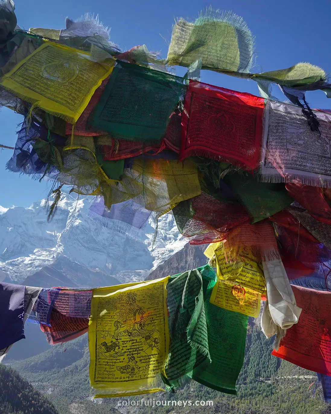
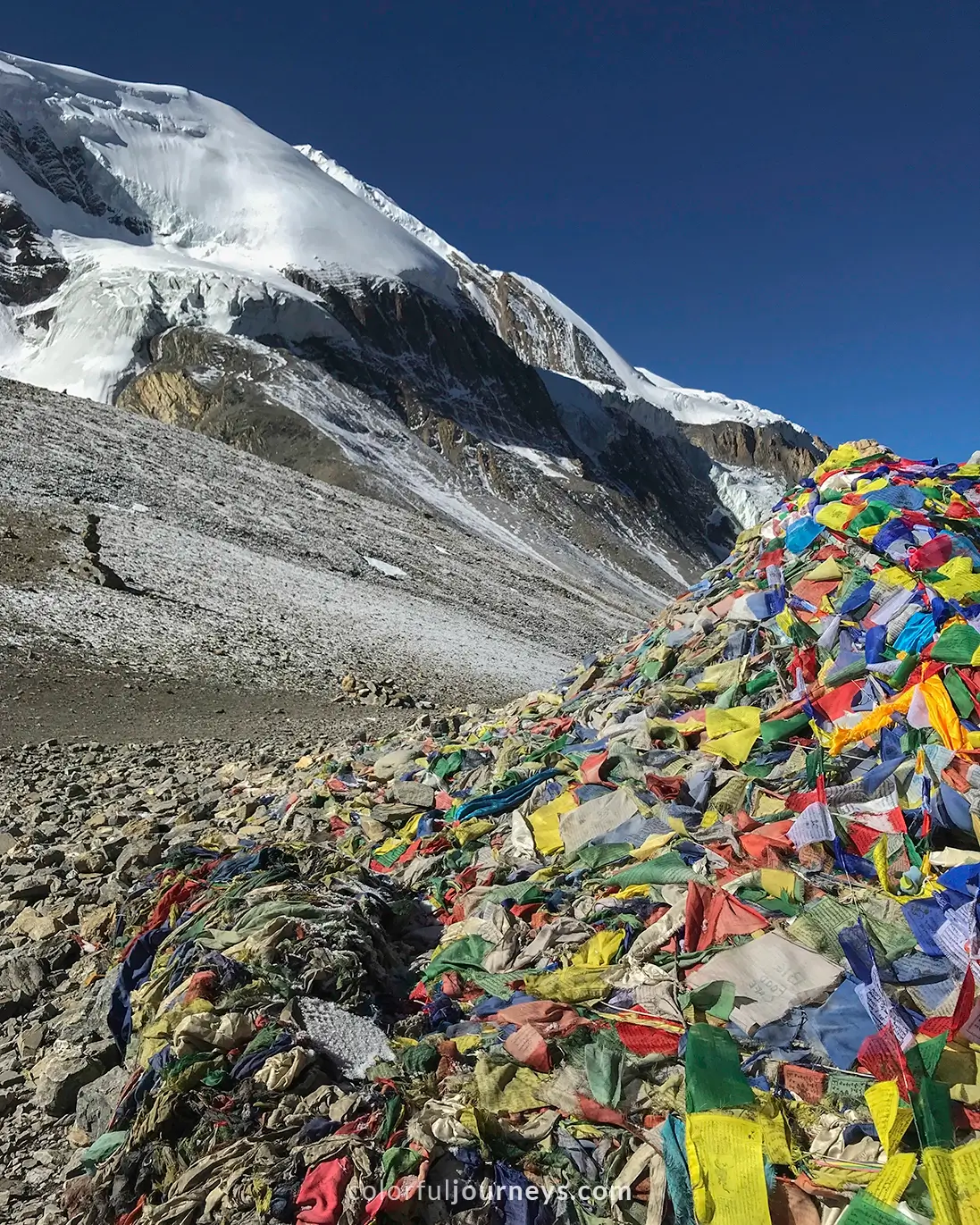
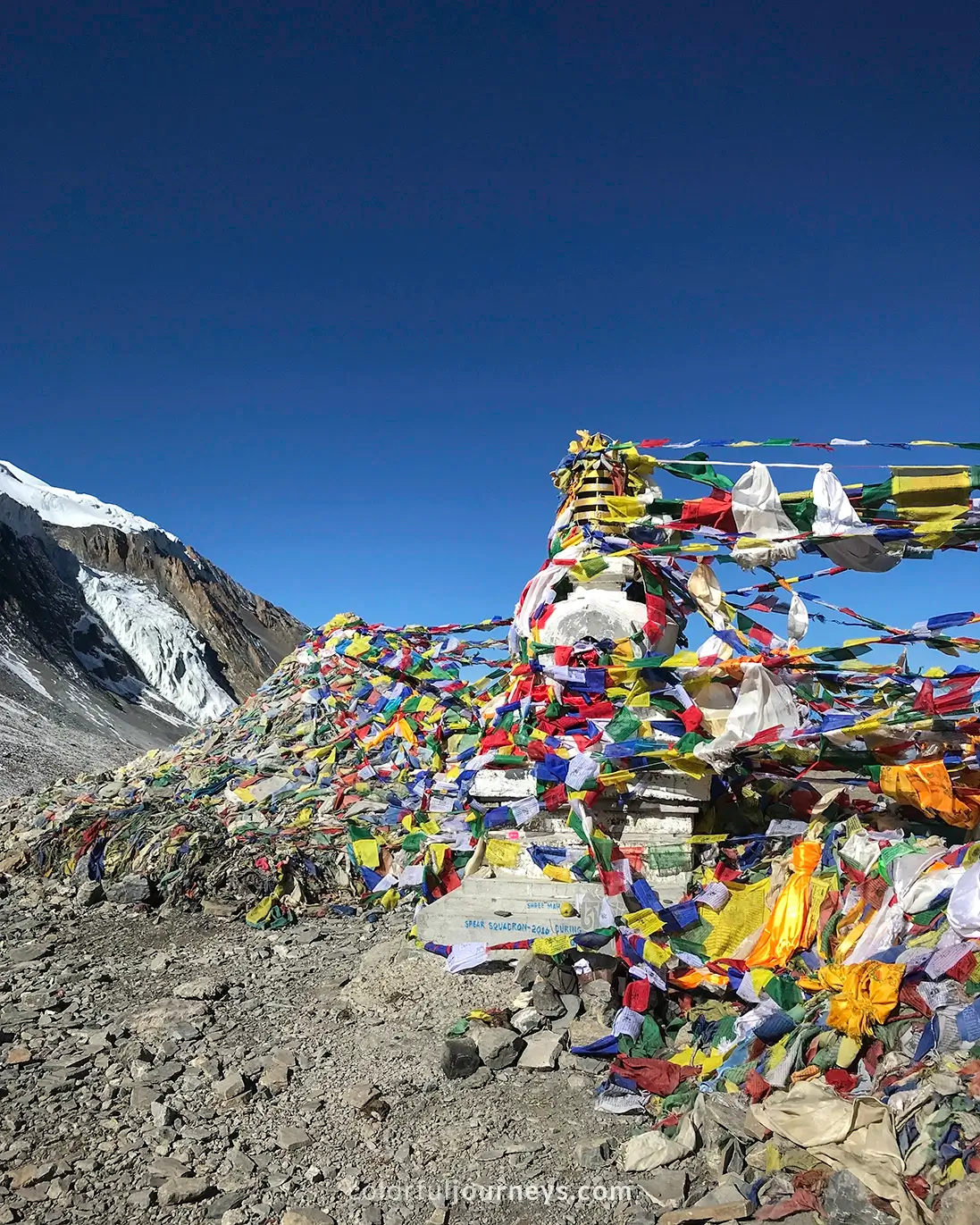
From the tea house, it’ll take another 2 and a half hours to reach the Thorong La Pass. As you gain altitude, you will feel more breathless. Take your time and continue to push through. You’ll know you’ve reached Thorong La Pass when you see the sign covered in prayer flags accompanied by countless people taking photos.
.webp)
After the pass, it takes about 4 to 5 hours to hike downhill on a rocky and slippery road till you reach the settlement of Chabarbu that serves lunch. As most people have lunch at this spot, it takes a while to be served.
Use this as a rest and after lunch continue on for another 2 hours until you reach Muktinath village (3760m). Though Muktinath offers multiple accommodations for trekkers, you might have a hard time finding one if you arrive later in the afternoon.
.webp)
My Experience
Today was undeniably the most difficult hike for me. I didn't check my headtorch beforehand, and it was empty. As a result, I hiked with my phone flashlight. This proved to be even more challenging because I had to use my hands to climb up parts of the trail. Other than that, the temperature was freezing, leaving my hands exposed even with gloves on.

This day was also the first time I walked on snow during the trek. My socks weren't thick enough to keep me warm, so I highly recommend investing in good quality socks and hiking boots!
My pace was much slower today, with the ever increasing altitude and my pounding headache. With every five steps I took, I had to take a pause. But once I reached the pass, everything just seemed so surreal, and I took my time to celebrate.
I thought the hardest part was done, but soon I found the downhill section was just as hard as the ascent. The descent however was soothing my headache.
We arrived at Muktinath around 5pm as our lunch took longer than we expected. Thankfully, we were able to stay at Hotel North Pole because of our guide friend who reserved a room ahead of time. Our room was very comfortable, warm, and spacious, which was all we needed after a grueling day.
.webp)
Muktinath to Pokhara
Elevation Loss: 2938m
Distance by Bus: 175km
Time by Bus: 8 to 10 Hours
Today marks the end of your Annapurna Circuit Trek.
If you have more time, you can continue on to Jomson, otherwise you can book a jeep or local bus to Pokhara (822m). The bus leaves at 7am and takes around 10 hours, while a jeep will take about 8 hours.
.webp)
The road back will take you past steep and narrow cliffs.The views are spectacular but the roads can be daunting at times. Especially when the road gets so narrow it makes you wonder if the bus even fits.
Tip: Sit on the right side of the bus, so you don’t look down the steep cliffs.
.webp)
My Experience:
We took the public bus back to Pokhara which broke down several times and it took us 16 long hours! Definitely not the best journey, but it’s one of those experiences that sticks with me, even till now. Do I recommend it to other travelers? Only if you have the time and are up for an adventure!
.webp)
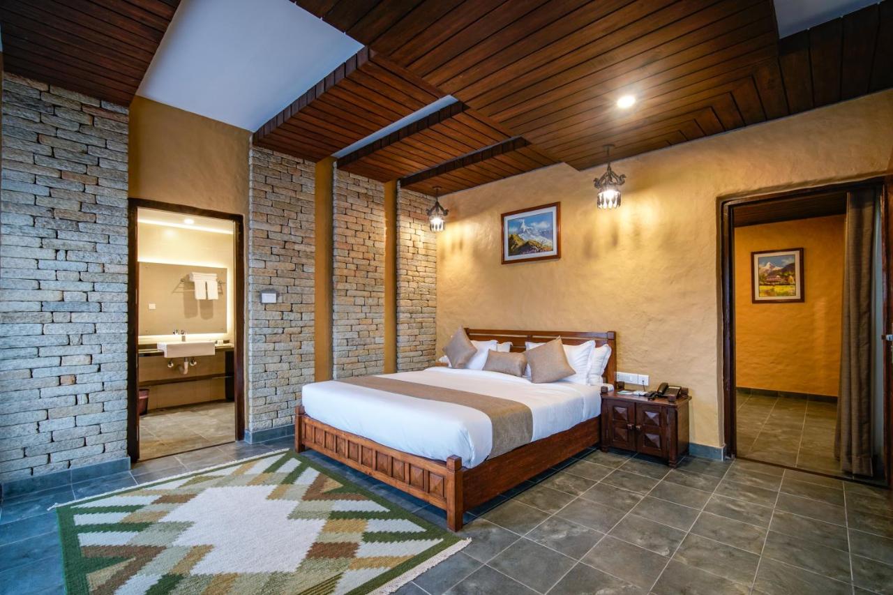
Looking for places to stay in Pokhara? Here are some of the most popular accommodations to book in the area.

Final Thoughts on Trekking Annapurna Without a Guide
Hiking the Annapurna Circuit is undoubtedly a challenging yet incredibly rewarding experience. From climbing those steep paths to enjoying the amazing views, every moment is a big win.
Yes, it is possible to do it on your own, without a guide! Just make sure you come prepared so you can make the most of your hiking adventure.
.webp)
And that’s the detailed 9-Day Annapurna Circuit Trek Itinerary.
Hiking the Annapurna Circuit is an unforgettable experience, from sweeping Himalayan views to the sense of achievement when you reach Thorong La Pass. To help you plan further, read our essential guide covering everything you need to prepare for the trek, including permits, packing tips, and practical advice you won’t want to miss.
Let us know if you have any questions and leave them at the comment section below.
Some links in this 9-Day Annapurna Circuit Trek Itinerary may be affiliate links.
This means that if you make a purchase after clicking on one of our links, we will receive a small commission at no extra cost to you. Please know that by doing so, you are supporting Colorful Journeys in continuing to provide free high quality content to help you in your travels!
.webp)
.webp)
.webp)